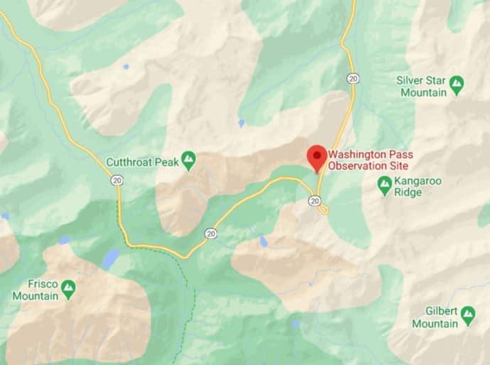
Washington Pass – Bad Roads for RVs is on the North Cascades Highway (Washington State Route 20). This road is steep. This route is between Newhalem and Winthrop. This route description covers both Washington and Rainy Pass on the same road, each with its own challenges.
This road is also very beautiful in good weather and although steep is manageable in good conditions and should be avoided in the winter shoulder seasons where it is likely to be wet and icy. Beginning in November however the road will be closed until April due to deep snowpack.
In the spring expect snowbanks on both sides of the road and water running across the road occasionally freezing into sheets of ice.
Here is our review of our trip in 2020 Northwest Washington and 2018 North Cascades National Park
Here is a link to the Washington Department of Transportation road conditions for North Cascades Highway.
Details
Elevation: Washington Pass – 5477 feet, Rainy Pass – 4875 feet. Between the two passes, the valley is at the Bridge Creek Trailhead at 3648 feet.
Length: 73 miles between Newhalem and Winthrop. Steep sections cover about 30 miles total.
Terrain: Numerous 4-6% descents with long sections of 7% grades.
Turns: Numerous turns requiring reduced speed in the 30 mile-per-hour range.
Rest Stops & Turnouts: From west to east: East Bank Trailhead at the east end of Ross Lake, Ross Lake Recreation Area Sign, Canyon Creek Trailhead, Beebe Creek, East Creek Trailhead, Easy Pass Trailhead, Pacific Crest Trail Roadside, Cutthroat Pass Trailhead, Bridge Creek Trailhead, Blue Lake Trailhead, Washington Pass Summit, Kangaroo Temple Trailhead, Cutthroat Creek Road, Lone Fir Campground, Early Winters Campground, and about twenty more roadside wide spots, some paved.
Runaway truck ramps: None
Bridges: Numerous, if the temperatures are at freezing with wet roads, expect bridges to be icy.
Travel Notes
Eastbound the climb to Rainy Pass Summit starts steep holds between 5-6% for about thirteen miles. There are two flatter sections of about 3 miles between the steep sections. Really the climb starts at Ross Lake and continues with some steep sections all the way to the top of Rainy Pass Summit. The descent eastbound from Rainy Pass Summit is 5-6% for about two miles to Bridge Creek Trailhead. The climb to Washington Pass from Bridge Creek Trailhead is steep at 6-7% grade for four miles. The eastbound descent from Washington Pass is 7% for seven miles with numerous 30 mile-per-hour curves. The first left turn after starting the descent is a switchback where it starts descending along with Early Winter Creek.
Westbound the climb to Washington Pass starts gradually gets much steeper starting when turning west from the Methow River Valley. After this, the road follows Early Winter Creek and the last 6 miles are very steep including one switchback. Westbound the descent from Washington Pass to Bridge Creek Trailhead is also steep at 6-7% grade for four miles. The westbound climb to Rainy Pass Summit from Bridge Creek Trailhead is 5-6% for about two miles. The westbound descent from Rainy Pass Summit is steep and gets steeper the further west you go. The grade holds between 5-6% for about thirteen miles. There are two flatter sections of about 3 miles between the steep sections. The descent continues all the way to Ross Lake.
Washington Pass – Bad Roads for RVs
We traveled the North Cascades Highway in our motor home from east to west in May 2020 and July 2018 without difficulty. The road is steep and but both the road conditions and time of year made it easy enough even though it is steep and deserves due respect.
Here is our link to our interactive map. Bad Roads for RVs

