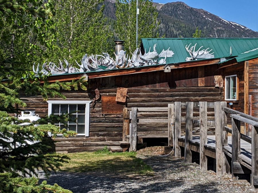
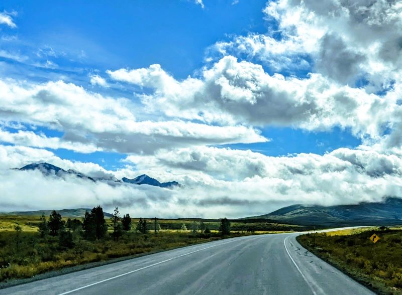
During the last week of August, we were back on the Alaska Highway, this time heading southbound on the Alaska Highway. The days are much shorter than during our first visit in June. Still in August, even all night long, even with sunset after 10 PM, it never gets dark at night.
It never gets dark (in the summer)
I am still amazed that it never gets dark at night (during the summer) in Alaska. Even in August after sunset, it is still light out, all night long, until sunrise. Sunrise during our visit to Tok in June was before 3:30 am. Sunset was 11:30 pm so compared to our visit in June with only four hours between sunset and sunrise it was darker twilight.

All roads lead to Tok
To start our journey southbound on the Alaska Highway we first traveled northbound to Tok from Valdez and Copper Center. Since we stopped in Copper Center to visit Kennicott it was an easy drive to Tok. Along the way, we had the Alaska Range to the west and the Wrangle Mountian Range to the east. Here is a link to the story about our longest one-day trip in Alaska. Kennicott Mines and Glacier

Our journey southbound on the Alaska Highway started in Tok. If you are going to drive to or from Alaska you will be going through Tok. It is the first town in Alaska on the Alaska Highway. Even if you come from Dawson City (Canada) you will be driving on the Alaska Highway through Tok.

The highways in Alaska are laid out in a big circle. At Tok, you have a decision to make. Do you travel the circle clockwise or counterclockwise? This decision will affect your entire trip around Alaska. If you go clockwise you will head south, starting at Tok, and head for the port cities of Valdez, Seward, and Homer first. If you go counterclockwise then you will first go further north to Fairbanks, then Anchorage, and visit the port cities later in the summer. If you want to go to the north of Fairbanks on the longest days of the year then counterclockwise is the choice.

If you go clockwise then you have to take into account that in June, in the port cities, rain is much more likely than it is during July and August. We didn’t take rain into account and we got lucky with our decision to go counterclockwise. We were the furthest north on the longest days and much of the rain was over before we got to the port cities. It still rains at least once a week everywhere we went in Alaska.

Our trip around Alaska
Starting in Tok, we took the counterclockwise route and visited Fairbanks, and Denali National Park, then worked our way to the Kenai Peninsula, south of Anchorage.
Here are a few links about our route. These locations are in order of our visits (counterclockwise) and if you include this article then this completes the route that we took around mainland Alaska. We started our Alaska journey by going northbound on the Alaska Highway and finished by going southbound on the Alaska Highway. Each of these links goes to blog posts about our route.
- Fairbanks
- Denali
- It is beautiful in Whittier
- The Kenai Peninsula
- Homer and the Homer Spit
- Halibut Cove
- Katmai National Park
- Grizzly Bear at Katmai
- Seward and Resurrection Bay
- Matanuska Glacier
- Valdez
- The Columbia Glacier
- Kennicott Mines and Glacier
Three more stops in Alaska
We were not done visiting Alaska even though we were heading for Canada. After departing mainland Alaska southbound on the Alaska Highway and crossing Canada we took a turn back towards the coast at Haines Junction and visited Haines and Skagway (both in Alaska). Then after going further south through Canada, we took another turn west of Watson Lake down the Stewart-Cassiar Highway making a brief stop at Stewart Alaska. It was September 18 and snow was in the forecast.

Our deadline to cross into Washington
To make it to the Washington Border would mean another 870 miles of driving measured from Stewart. We planned to cross into Washington at the beginning of October. We needed to be in Vancouver, British Columbia before October 1st because north of Vancouver they have a law that requires us to carry chains for our vehicles. The same law applies in numerous places in the United States and October 1st is usually the start date for the chain laws.
Southbound on the Alaska Highway
When we departed Tok we were back in familiar territory except that it was no longer spring but rather it seemed like summer was nearly over. Fall colors were starting to show on the trees even during the last week of August. On our trip north we took the leg from Koidern to Tok all in one day. On our trip southbound we stopped at Deadman Lake near Northway. As we traveled north I was keeping track of places we could camp on our way southbound on the Alaska Highway.

Tetlin National Wildlife Refuge
South of Tok, along the Alaska Highway, is the Tetlin National Wildlife Refuge. It is nearly one million acres of wilderness mostly only accessible in the winter when covered with snow and ice. In the winter, you can use a snowmobile to explore some of the closer locations in the refuge. In the summer, access is limited either to one of the few roads or by float plane. Going off-road isn’t easy in the summer. Most of the Tetlin National Wildlife Refuge is a swamp (muskeg) on the top of permafrost. The frozen ground prevents drainage. It isn’t warm enough in the summer to melt the ice hiding below the surface of the ground.
To the south of the Tetlin National Wildlife Refuge is the Wrangel St. Elias National Park and Reserve. To the east is Canada. North of the Tetlin National Wildlife Refuge is more inaccessible wilderness. The wilderness area(s) to the north changes names but goes all the way through the Arctic National Wildlife Refuge and the Arctic Ocean. Most of the low-lying area is muskeg sitting on permafrost. Muskeg is a thin layer of vegetation and peat that in this area sits on top of permafrost.

Camping in the Tetlin National Wildlife Refuge
To camp inside the refuge we had one choice, Deadman Lake. Deadman Lake (both the lake and the campground) is unique because it is surrounded by muskeg and permafrost. The campground at Deadman Lake is built on top of the permafrost.
Permafrost is the reason that this section of the Alaska Highway is constantly being repaired. The section south of Tok had been under construction all summer. By the time we were southbound on the Alaska Highway, at the end of August, only one small section near Northway was still in the construction zone. The freshly repaved road was much better in August than it was in June.

The area south of Northway is a flat nearly featureless plain of muskeg permafrost. The only exception to the muskeg is that the area is dotted with small lakes. This area gets some of the coldest winter weather in Alaska and Canada. Minus 40 degrees is common. A little south of the ALCAN border the record low temperature during the construction of the Alaska Highway was recorded at minus 78 degrees Fahrenheit. A few years before our stay, Deadman Lake froze to the bottom killing all the fish in the lake.
On Deadman Lake
We had an adventure on Deadman Lake. Even though we carry our kayaks everywhere we go at Deadman Lake they have free canoes so our first adventure on Deadman Lake was in a canoe. Tami had never been in a canoe before. Until she met me Tami had never been in a kayak before. So since the price was right, this was an opportunity not to be missed. Canoes are different than kayaks, especially two-person canoes. We had to exercise teamwork that we never tried before in kayaks.

Canoes (especially free Alaska canoes) are heavy and compared to our kayaks they were very slow. It was quite a different paddle trip. After one try for less than an hour we got used to the teamwork and headed back to camp. On the way back to the boat launch in the canoe, we could even go in a straight line for short distances. The next time we came out we had no doubts that we were kayakers and paddled around the entire lake.

While kayaking at Deadman Lake I got to use my Alaska fishing license one more time. Tami and I went for a wonderful evening paddle across the lake and much like I used to do on every kayak journey this time I spent lots of time fishing. I knew about the freeze kill a few years prior and didn’t expect to be too successful but was able to catch a few small pike.

Into the Yukon
After a relaxing stay at Deadman Lake, we then drove to and into Canada at the ALCAN border crossing. Our next stop is one of the places that we stayed at in May while we were northbound on the Alaska Highway. Discovery Yukon Lodgings is a wonderful place. It is a combination of RV sites and a motel for travelers without RVs. They have a huge runway capable of landing the largest backcountry aircraft.

Discovery Yukon Lodgings was more popular when the Alaska Highway was dirt and even rougher. When the road was rougher travel was slower and Discovery Yukon was nearly a mandatory stop. On the above map, it is near Koidern. Koidern is a location, not a settlement. The only civilization near Koidern is Discovery Yukon Lodgings. In the past, Discovery Yukon Lodgings started as a construction outpost when building the Alaska Highway.

I will pick up the story next week about Discovery Yukon Lodging. It is part RV park but it is also a museum about building the Alaska Highway.
Please subscribe and join us on our journey
We will add you to our email list and send you updates about once a week. Here is a link. Subscribe
About our links
As you know, our blog income is zero – this allows us to be independent and just tell the truth. We do not get income or commissions. No, we don’t make paid endorsements. We don’t make recommendations but instead, we will tell you what we like (or dislike). The links are only provided as a quick reference to help our readers.
Links
The Milepost Guidebook found on this website is updated annually and you can use the book even without internet data. First published in 1949 it is the bible for travel in Alaska and northwestern Canada.
Historic Mileposts on the Alaska Highway website with key mileposts
Alaska Highway 75th Anniversary
About Comments
We love seeing your comments but they are not automatic. I get about twenty spam comments every day and thus I don’t have automatic comments. I read and then publish every comment personally to protect the blog and keep it on the subject and real. So what this means for you is that you will not see your comment right after you hit submit. Sorry for the delay in publishing your comments. Please know that we love hearing from you.


Love all your travels. Be safe.
Yep, the difference between canoes and kayaks cannot be understated. You would think it would be kinda similar, but not at all… LOL. Anyway, now you all know for sure – kayaks it is!
Pingback: Make sure to stop at Discovery Yukon Lodgings - FoxRVTravel
Love your stunning photos.
Pingback: Our 2023 epic travel adventure - FoxRVTravel