Homer is the furthest southwest point in Alaska that we can go in our RV without getting a very expensive ferry involved. The Homer Spit is south of Homer. There are roads in Alaska, south of Homer but, these roads are not connected to the road system on the Alaskan mainland. In some cases, they connect to Canada, and in other cases, they don’t connect to any other road system.
In our travels, we have explored some of these more remote roads, In Sitka, these roads are on an island. Of course, there are roads in Juneau, but they too are not connected to Alaska or Canada’s road system. Instead, these cities are connected by the Alaska Marine Highway, not roads.
Homer
Homer sits on the southwest corner of the Kenai Peninsula. Homer is the self-proclaimed Halibut Capital of the World. Kachemak Bay to the east, and the Cook Inlet to the southwest of Homer, have the water depth and food sources to keep that title intact. Homer doesn’t have a massive river that supports huge salmon runs, so they don’t have as many salmon as does the Kenai River to the north. Here is a link to our story about our stay on Kenai Lake. Alaska’s playground is the Kenai Peninsula

East of Homer
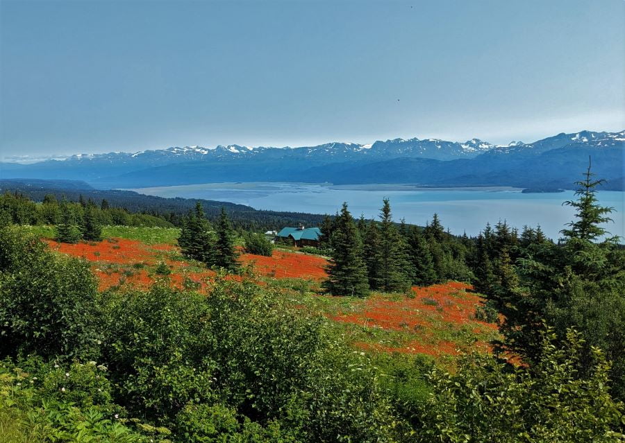
The part of the Kenai Peninsula to the east of Homer is gentle compared to much of Alaska. It doesn’t have the steep mountains or glaciers found on the south side of Kachemak Bay. It also doesn’t have the bitter cold associated with the interior of Alaska. To the east of Homer, on the Kenai Peninsula, there are small and large ranches and summer homes. Don’t expect services such as a gas station once you leave Homer heading east.

Pioneer Avenue in Homer turns into the appropriately named East End road that eventually splits into Basargin Road and Falls Creek Road. Basargin Road leads further east to Fox River and Razdolna. Both of these locations are places not towns. Eventually, the road becomes a very steep jeep trail that ends in a very tiny town named Kachemak Selo.
Kachemak Selo
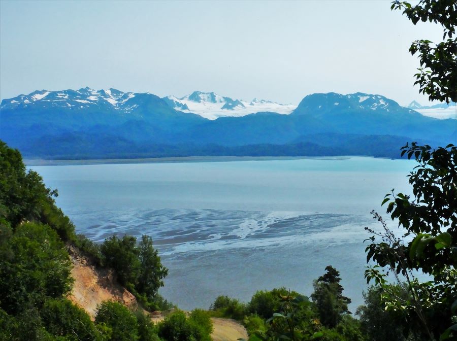
Kachemak Selo (Selo is a Slavic term that means village) is a small community at the head of Kachemak Bay. The tiny town dates back to the Russian ownership of Alaska. From where we parked (at the top of a very steep hill) Kachemak Selo is about a half mile toward Katchemak Bay. At this point, Kachemak Bay becomes very shallow. Often the outgoing tides uncover the bottom of the bay. Kachemak Selo, Vozenesenka, and Rozdolna are at the end of Basargin Road. These communities are (Russian) Eastern Orthodox people, who moved to Alaska and were escaping religious persecution by Russia before and during the Soviet Revolution.
Homer Spit
To the south of Homer, extending four miles into Kachemak Bay is the Homer Spit. As the glacier carved Kachemak Bay (advancing) it pushed rocks in front of the ice like a giant bulldozer. The Homer Spit is a narrow stretch of land that is the remnant of the glacier moraine at the point of its maximum advance.

It is as if the glacier was a giant shovel pushing dirt as it grows. The glacier also acted like a giant conveyor belt gathering rocks as it carved away the mountains. The combination of rocks and pushed rocks is then deposited at the leading edge as it recedes creating a natural dam. The Homer Spit is an example of a natural dam created by a glacier.

The Homer Spit was pushed westward as the glacier advanced and deposited when the glacier retreated. To the west of the Homer Spit is the deeper water of the Cook Inlet and to the east along the north shore of Kachemak Bay, is shallow water. The shallow water to the east along the north side of Kachemak Bay are rocks deposited by the glacier as it retreated. Some of the shallow water on the north side of Kachemak Bay is caused by erosion from the Kenai Peninsula.
The Salty Dog Saloon
The story is that the Salty Dog Saloon, near the end of the Homer Spit, was the only building standing after the 1964 earthquake and tsunami. This is partially correct The Salty Dawg was one of the first cabins built in 1897 in Homer, not on the Homer Spit.
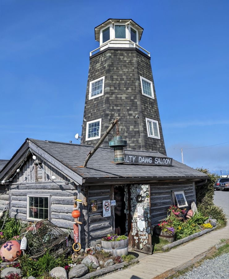
At one time or another, it was the first post office, a railroad station, a grocery store, and a coal mining office. In 1957 it served as the office for Standard Oil. The saloon didn’t open until 1957. In 1960 the Salty Dog Saloon was sold. In 1964, after the earthquake, it was moved to its current location, near the commercial boat docks, at the end of the Homer Spit.
After the earthquake, most of the structures on both Homer and the Homer Spit were destroyed. There was plenty of room on the Homer Spit and the Salty Dog was moved there. The lighthouse structure was added to cover up a water tank. The lighthouse looks much better than a water tank.
Kachemak Bay
Kachemak Bay divides the Kenai Peninsula almost connecting to Tustumena Lake much further to the north. To the south of Kachemak Bay, is both the Kachemak Bay State Park and the Kenai Fjords National Park. Both of these parks are associated with the Harding Icefield which was the source of the glaciers that carved both Kachemak Bay and Tustumena Lake. Someday, Homer may be on an island if the glaciers connect Kachemak Bay to Tustumea Lake. It would not take much (geologically, probably not more than a few thousand, perhaps ten thousand years).
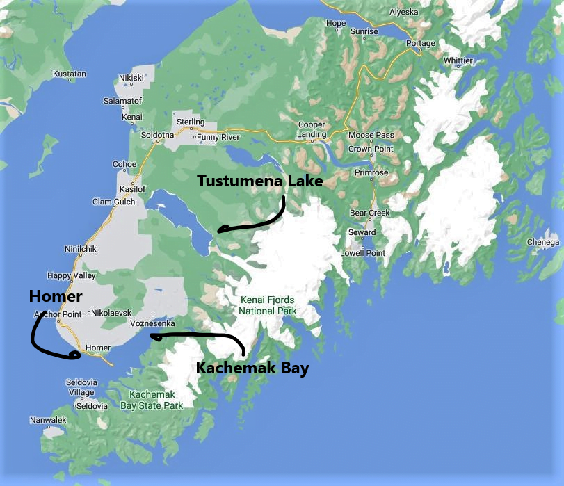

The bottom of Kachemak Bay falls off abruptly as you proceed southwest from the Homer Spit so that only a few miles to the southeast the water depth is nearly 500 feet deep. This deep water and tidal movement of up to 25 feet created the habitat that made Homer famous for halibut fishing.
Our Visit
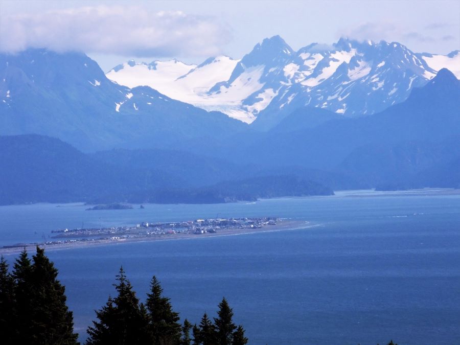
We used Homer as a jumping-off point to visit several nearby locations. Our trip to Homer started in Sterling as we took the Sterling Highway south along the west side of the Kenai Peninsula. Our first glimpse of Kachemak Bay included the Homer Spit, our destination for the week. With a zoom lens, (photo above) I was able to pick out our campground at the very end of the spit. The photo above includes the spit, Kachemak Bay, and the Grewingk Glacier. I was hoping for even more dramatic views with clear skies but they never came.

After driving our RV through Homer, we worked our way down the spit to the very end. Our campground was too close to the commercial docks and even though it occasionally had an ocean view it was usually packed and we neither had a view, quiet, or room between RVs. If I had to do it over again I would have stayed at the budget campground without hookups at the north end of the spit.
What is next
I mentioned that we used Homer as a jumping-off point for further explorations to the south and southwest. From Homer, we took an old fishing boat converted to passenger use to Halibut Cove and we also took a float plane to Katmai National Park. So from this, you can tell what I will be writing about for the next two weeks.
Please subscribe and join us on our journey
We will add you to our email list and send you updates about once a week. Here is a link. Subscribe
About our links
As you know, our blog income is zero – this allows us to be independent and just tell the truth. We do not get income or commissions. No, we don’t make paid endorsements. We don’t make recommendations but instead, we will tell you what we like (or dislike). The links are only provided as a quick reference to help our readers.
Links
About Comments
We love seeing your comments but they are not automatic. I get about twenty spam comments every day and thus I don’t have automatic comments. I read and then publish every comment personally to protect the blog and keep it on the subject and real. So what this means for you is that you will not see your comment right after you hit submit. Sorry for the delay in publishing your comments. Please know that we love hearing from you.

As Always, I enjoy your posts. I do hope the pictures that gave glimpses of the road, do not give a representation of all roads, as they looked no more than packed dirt! Keep ‘um coming!
Loving your trip. Thanks for taking us with you.
Just beautiful, and I feel like we have the best curators sharing it that we could have.
Just beautiful, and I feel like we have the best curators sharing it that we could have.
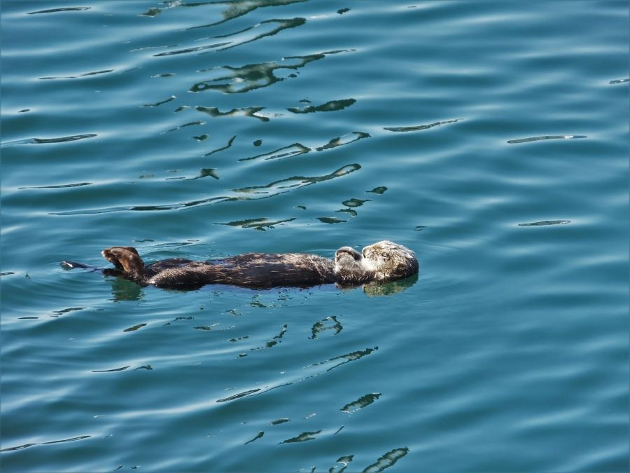
The only thing more exciting than a sea otter is a trip on a float plane into the heart of an amazing national park. Looking forward to the next chapter!
You two are braver than we are…I didn’t want to be out on the spit! Looking forward to your grizzly pictures!
Now I’m a bit (just a bit) jealous. I really wanted to stay on the spit. But, as I mentioned before, we could hardly negotiate our way through, it was so crowded. I fill up with nostalgia every time I read one of your posts. I am ready to return, perhaps in the winter (not with our 5th wheel!).
Pingback: Valdez is the most important city in Alaska - FoxRVTravel
Pingback: Southbound on the Alaska Highway - FoxRVTravel
We just returned to our PA home after a wonderful trip to Alaska in general and the Homer spit in particular.
My family lived in Alaska back in the early 50’s with our final stop on the Spit for about 5 – 6 months. At the time, maybe 1950 or 1951, there were only three things out there. One was a small king crab processing facility, a small dock with a warehouse, and our trailer in between.
Unfortunately all of the pictures my parents had regarding our time on the spit have gone missing hence the reason for this post. I am trying to find directions to who might have information, pictures, and knowledge of the Spit during this period.
Since I am the only one left in our family, I am trying to reconstruct what was a great period of my life. There was a little boy who’s mother work at the crab factory would play with my sister and I. Anyway, if anyone has anything they can share it would be greatly appreciated.