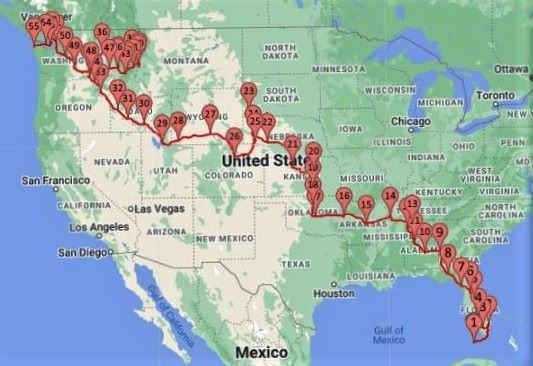
We made it to the end of the road. Starting in Key West in January our goal was to cross the country from corner to corner. We made it all the way. Perhaps in a couple of years, we will repeat the adventure of crossing from San Diego to the far northeast corner of Maine. That sounds like a good complementary route to this one.

Key West
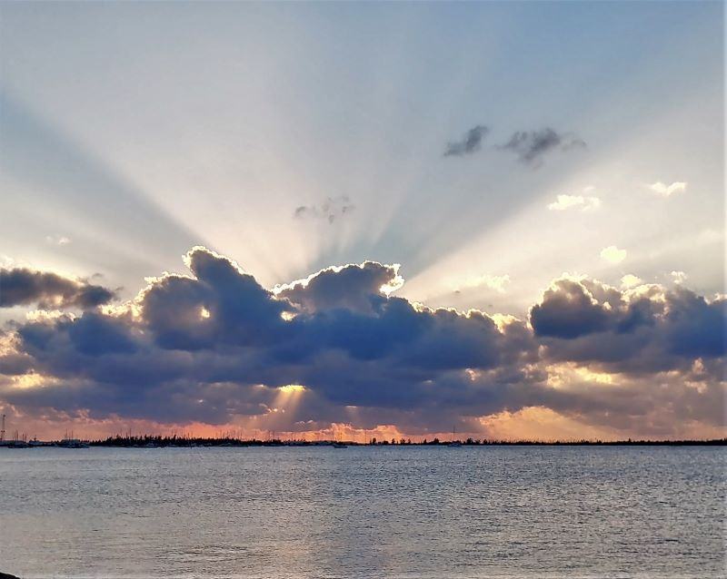
Our 2021 journey ended in Key West on January 1st. We made it there with time to spare. I find it fitting that our stay in Key West started our 2022 journey. Of course, I have several photos of sunsets in Key West (and in the post titled Key West Sunsets), but I think that my best picture of a sunset in Key West is this one.

If you haven’t visited the post about Key West Sunset there is a surprise at the end with links to multiple posts containing wonderful sunset pictures that we have taken over the years. This includes the sunset picture of our RV, in San Diego, overlooking the Pacific Ocean. I am pretty proud of that one, as it was chosen for the cover photo of the Family RVing magazine. I guess the thing I remember most about our stay in Key West is the sunsets. Here is a link (again). Key West Sunsets
At the other End of the Road
At the other end of the road, all the way across the country, we stayed on the Olympic Penisula and in Olympic National Park. This end of the road is home to the Makah Indian Tribe. Their reservation covers most of the northwest corner of the Olympic Penisula. Both Callam Bay and Neah Bay are traditional Makah fishing villages. Neah Bay is the last town on Highway 112 and has a very good museum documenting the Makah people.

Cape Flattery
To the northwest of Neah Bay is Cape Flattery. The parking lot for the Cape Flattery trail is at the end of the road. From there it is a footpath. This leads to the Cape Flattery Lighthouse overlook platform. Cape Flattery is a rock outcropping a little further north of the lighthouse overlook platform. A little southwest of the overlook platform is Kessiso Rocks. The problem with going to either of these two other locations is the lack of trails.

The purpose of this trail is to see the island and the lighthouse. The top picture in this post has our smiling faces and you can see the island in the background, but fog shrouds the lighthouse. Moisture is typical at this location, and this was the reason the lighthouse was put here in the first place. Still, the trail was good and the walk through the forest was very nice.

The forest here was very interesting, almost a rainforest but really its biggest influence was the abundant coastal moisture. They get plenty of rain, but even in the summer, it is moist. What they don’t have is abundant sunshine.

Rocky Cliffs
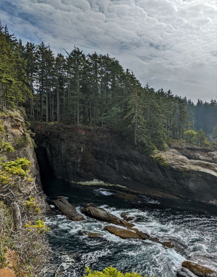
Near the end of the Cape Flattery Trail, you start getting glimpses of the Pacific Ocean. They get huge waves here and these granite islands are often sprayed with seawater as the waves crash against their foundations. You can see the erosion at the bottom. On the day we visited, the ocean was very calm and very pretty but still, the waves were a couple of feet high. A couple of years back we took pictures of some truly awesome waves pounding the Washington coast. I even included a seven-second-long video of Cape Disappointment in that post. Here is a link to that post. Stormy…


Between Key West and Cape Flattery
Besides seeing our family both in Boise and Bellingham Washington, and complaining about the weather (our only spring was in the middle of May in Boise), the thing that impressed me most was following the Lewis and Clark Trail. We were following the Lewis and Clark Trail, starting in Lolo, Montana all the way across Idaho. Here is a link to our travel along the Lochsa River. The Lochsa River
Cape Flattery Lighthouse
Eventually, we got to see the Camp Flattery Lighthouse peeking out of the fog as the day warmed. It was fun to watch the fog gradually lift and the lighthouse being revealed very slowly. Unlike most of our pictures that are taken on a hike or from our travels in the car, this one took some time.

What is next
It is time to turn south but there is so much to see here on the Olympic Penisula. Weather, especially winter weather, has a lot to do with our travels. So, starting at Cape Flattery, our goal is to head south and keep heading south until we are in San Diego. We will cover three different corners of the United States all in one year. Of course, the goal is contrived of our own ambition but just the same, without a goal and without heading south, winter is going to catch us, and when it does we want to be someplace mild. Like Key West or San Diego.
Our visit to Olympic National Park
We visited Cape Flattery while visiting Olympic National Park. Going to the end of the road was optional but not for us. Here are links to our stories about the other things we explored while in the area.
Please subscribe and join us on our journey
We will add you to our email list and send you updates about once a week. Here is a link. Subscribe


Great pictures. We are just finishing our river cruise on the Danube. Been posting pics on FB.
keep um coming! I love you reference prior posts. can wait to hear about San Diego
A fun read AND look-see.
Thanks
Judy
Thanks for sharing your adventures. Your e-mails were very informative & enjoyable reading.
Thanks Again,
Enjoy,
Wonderful in Retirement in Morrisville,
Jersey & Joan
How many miles did you drive on your trip from Key West to Cape Flattery?
I’ve always liked the idea of “themed” travel or people who have some sort of goal in mind as they go from place to place. We know other RVers who extensively explored the Lewis and Clark trail, and I love your idea of going from one corner of the country to the other in a single year. But yeah, now is the time to head for San Diego! Have a taco for me when you get there!
End of the Road is my favorite post of yours! Thank you for sharing some amazing corners of this great and vast country of ours!
Idea: reach out to a publisher/software for American students to see, learn about and appreciate the finer qualities of our homeland!