Hurricane Ridge is the easiest place in Olympic National Park for most people to visit. It is located about eighteen miles south of Port Angeles, which has an airport and most of the area’s hotels.
Olympic National Park is divided into two sections: the main park and the coastline. Both are part of the park. The main part of the park is the mountainous region (including Mount Olympus), and there is an extensive coastline section to the west of some private property. The biggest part of the main section of Olympic National Park is only accessible by trail.
Few Roads
Only a few roads enter the Olympic National Park. U.S. Highway 101 goes around the park on the north and west sides. Hurricane Ridge Road on the north side and Hoh Rainforest Road on the west side are the major roads into the main part of the park.

Our Visit
We wanted to visit every section of the park, including the main section and the coastline. Our first trip into the park was to Hurricane Ridge, which we visited on a day trip while staying in the Dungeness Recreation area north of Sequim.
I mentioned Sequim in my previous post about the Olympic Rainshadow. Hurricane Ridge also benefits from the Olympic Rain Shadow, although not nearly as much as Sequim. Here is a link to that article. Olympic Rain Shadow
From Port Angeles
Hurricane Ridge is the area of the park closest to Port Angeles. The directions are easy, but the road’s name changes thrice for some reason. From Highway 101 in Port Angeles, turn south on Race Street. As you pass Park Avenue, the name changes to Mt. Angeles Road. The “in-city” Olympic National Park visitors center will be on the right side just south of Park Avenue. Just after passing the visitors center, there is an intersection, stay to the right and you will be on Hurricane Ridge Road.

Heart-O-Hills Campground
At Lake Dawn, Mt. Angeles Road reconnects with Hurricane Ridge Road. This small section of Mt. Angeles Road, however, does not connect with the main Mt. Angeles Road that was in Port Angeles. To the south of this intersection is the Heart O Hills Campground. Heart-O-Hills campground has many trees and shade. It is open year-round and operates on a first-come, first-served basis.

There are only a few campgrounds in Olympic National Park that take reservations. Heart-O-Hills campground is not one of them. Campground reservations (for campgrounds that take reservations) are only available in the summer season.
Hurricane Ridge
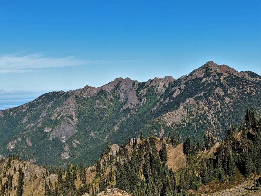
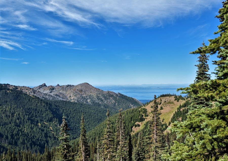
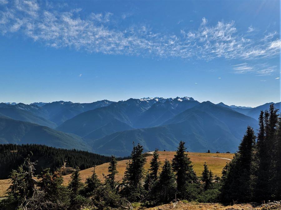
The visitors center is about eighteen miles south of Port Angeles. It has a small park store with a typical assortment of tee shirts and similar items. What makes it unique is that it has wonderful views of the mountains. The views to the south are amazing but don’t forget to look in the other directions.

As you can tell from the pictures, the mountains to the south are further away than the peaks in the other directions. Between the visitors center and Mount Olympus is the Elwah River canyon, which flows north and into the Strait Juan de Fuca to the west of Port Angeles.

Elwha River
The Elwha River is short (45 miles long) but is the major river in the park area. During the rainy season, it flows at forty thousand cubic feet per second. For my fishing friends, now that the dam has been removed, salmon should return to the river, and assuming you are there in the summer, the river will be pristine after the spring runoff. In addition to several species of salmon, steelhead trout and ocean-run cutthroat trout are in the river at different times of the year.

Hurricane Hill
A little to the west of the visitors’ center is the trailhead for Hurricane Hill. This paved trail (yes, I said paved, with asphalt) was decided to be paved due to the high traffic level and rainfall. The Hurricane Hill trail is almost three and a half miles long and very steep, climbing a thousand feet vertically. It is very popular. The rainfall in the area probably made trail maintenance an annual nightmare.

Wildlife
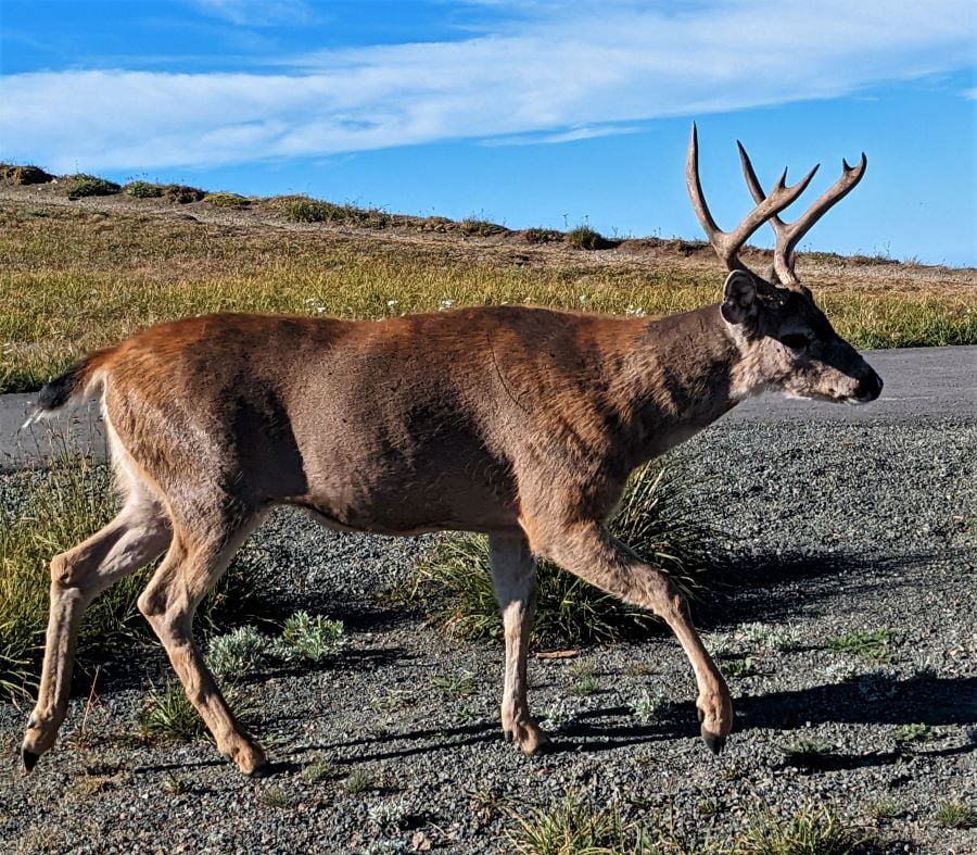
Like most National Parks, the wildlife does not consider tourists (us) a threat. I didn’t approach this buck. Instead, he approached me not to come to me, but instead, I was just along the path that he was using. Remember the asphalt trail I mentioned; it is also right behind the buck in this picture.

Our route
As I already said, we visited Hurricane Ridge while staying in Sequim. Then, we drove further west (on a different day) and visited Crescent Lake. I think that it may be the prettiest alpine lake we have seen in our last five years of travel. Arguably, Crescent Lake is prettier than Crater Lake and Lake Tahoe, both of which are stunning.
Changing campgrounds, we went to Forks Washington and visited the westernmost point of the continental United States. From Forks, we went back east and camped at the Hoa Rainforest and the Olympic National Park coastal area at the beach.
I hope you like the stories about the Olympic National Park. I have lots more blog posts to write about the subject.
Olympic National Park year-round playground
Hurricane Ridge gets visitors every season because it is close to Port Angeles. In the winter, there is a small ski area. In the spring, you might want to check the forecast for high winds; I’m just saying that it is named Hurricane Ridge for a reason. For us, at the end of the summer season, going to Hurricane Ridge was a great introduction to the Olympic National Park. We got great views of the Olympic Mountain range and even a view across the Strait of Juan de Fuca to Canada.
Our visit to the Olympic National Park
Quinault Rainforest and Kestner Homestead
Please subscribe and join us on our journey.
We will add you to our email list and send you updates once a week. Here is a link. Subscribe
About our links
As you know, our blog income is zero, which allows us to be independent and tell the truth. We do not get income or commissions. No, we don’t make paid endorsements. We don’t make recommendations; instead, we will tell you what we like (or dislike). The links are only provided as a quick reference to help our readers.
Links
Hurricane Ridge Visitor Center
About Comments
We love seeing your comments, but they are not automatic. I get about twenty spam comments every day, and thus, I have to turn off automatic comments. I read and then publish every comment personally to protect the blog and keep it on the subject and real. So this means that you will not see your comment right after you hit submit. Sorry for the delay in publishing your comments. Please know that we would love to hear from you.


Beautiful area!
I can’t wait to see your post about Crescent Lake. I don’t think any lake could equal the beauty of Lake Tahoe.
We are two years out from our trip to the northwest. Your trip is providing us with an agenda. Thanks for the bucket list!
Beautiful pictures! Did you go out to Cape Flattery? Happy travels!!
Pingback: Exploring the Puget Sound - FoxRVTravel