On our Alaska trip, we crossed the Yukon on the Alaska Highway. It has been a wonderful drive on a horrible road. This road has always been horrible. Much of it is a nonstop pothole. This section of the Alaska Highway crossing the Yukon was the hardest to build and the hardest to maintain. Every year major sections of the road are under repair and this year is no exception.
Is the Alaska Highway the better way to cross the Yukon or is taking the longer route across the Yukon through Dawson City a better route? Time and perhaps memory loss may determine if we will ever do it again or perhaps maybe the long way through Dawson City might be the better way.

This is part three of our journey to Alaska and includes crossing the Yukon on the Alaska Highway. If you want to drive to Alaska, there are two ways. The shorter way to Alaska is the road that we are on. The longer way to Alaska includes going through Dawson City. Both include crossing the Yukon Territory and both ways are difficult. Even after our trip on the Alaska Highway and hearing stories about the Dawson City route, I cannot tell you which way is worse. I can tell you that our route wasn’t horrible but some sections were very bad. As the saying goes, “It could have been worse”.
Previous stories about our trip to Alaska
We made a quick trip north across the United States starting in Tucson to Great Falls, Montana. Then we went north, through Alberta Canada. Here is a link. Crossing Canada, going to Alaska After that we had to find a way to get around the wildfires in northern Alberta by going through British Columbia. Here is a link to that story. Our route around the wildfires in Alberta
This next link is about the first leg of our Alaska Highway adventure. Going North on the Alaska Highway Here is a link to the second leg of our Alaska Highway story. Stunning Northern Rockies on the Alaska Highway This story (the third in the series) is about crossing the Yukon on the Alaska Highway. Next week the story will be about the final and even worse section of the Alaska Highway when we cross into Alaska and complete our journey northbound on the Alaska Highway.
Building the Alaska Highway across the Yukon
Building the Alaska Highway across the Yukon was all part of the monumental effort during 1942. I detail parts of the story in the links in the previous paragraphs. The Alaska Highway starts in Dawson Creek and mostly without the aid of following previous roads, connects Dawson Creek to Fairbanks Alaska.
Small sections of the Alaska Highway already existed but the largest part of the Alaska Highway was untouched wilderness prior to 1942. The purpose of the Alaska Highway was to make sure that the Japanese could not cut off northern Yukon and Alaska from the rest of Canada and the United States by blocking the seaports in Alaska.
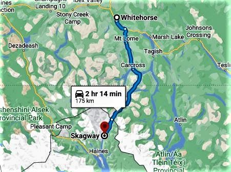
The Army Corps of Engineers arrived in Dawson Creek in March 1942 and immediately started building the road to the north from Dawson Creek, through Forts Saint John and Nelson. Just after they arrived in Dawson Creek more Army Engineers arrived by boat in Skagway then took a train to Whitehorse and started building the road south towards Dawson Creek and also northbound towards Alaska.
Whitehorse
Whitehorse was the center of the effort when building the middle sections of the Alaska Highway. From Whitehorse, they built to the east to Watson Lake then turned south to meet with the northbound road-building crew coming north from Dawson Creek. The first priority was to get a connection (southbound) between the United States and Whitehorse. At the same time, more road-building crews arrived in Whitehorse from Skagway and started building the road north toward Alaska.

Yukon River
Whitehorse was unique in that it had rail access to the port in Skagway and also river access on the Yukon River. From Whitehorse, prospectors took the Yukon River north to the goldfields in Dawson City and Eagle Alaska.

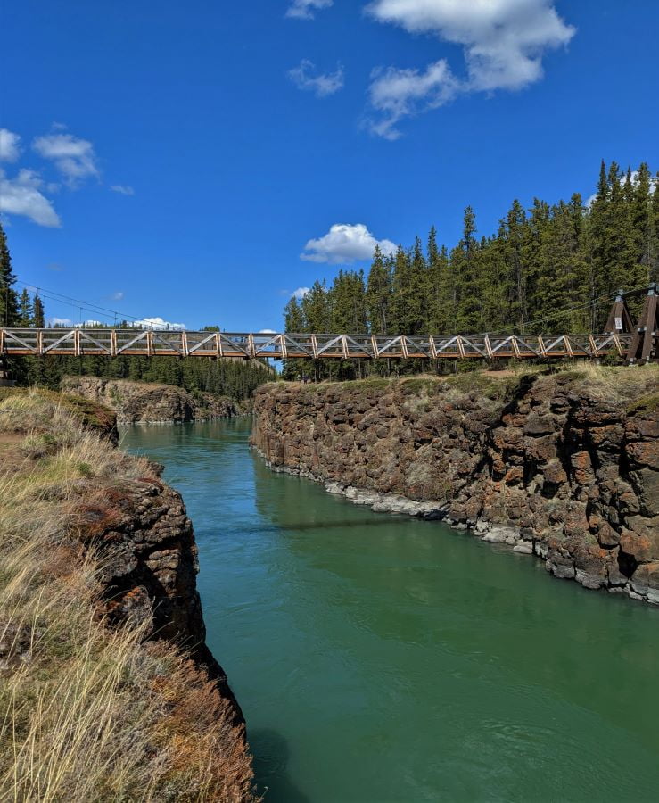
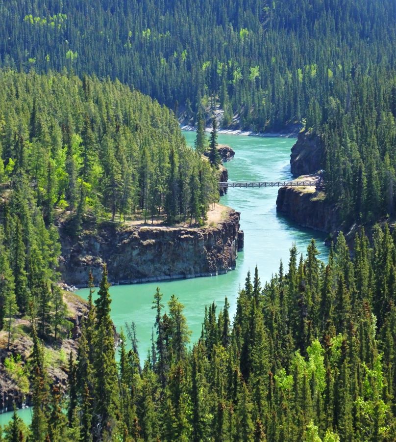
The elevation of Whitehorse is 2,100 feet above sea level. Whitehorse is the highest-elevation city in the world where a boat starting at sea level can travel upriver. No other river in the world is navigable from sea level to this elevation. Boat navigation stops because the river climbs too high– too fast. Rapids and waterfalls don’t work well with upstream boat traffic. The same thing is true on the Yukon River in Whitehorse at Miles Canyon.

Every part of our journey on the Alaska Highway in this article was built by crews working on the Alaska Highway going both north and south starting in Whitehorse.
Our Route, crossing the Yukon
Our route crossing the Yukon on the Alaska Highway for this part of our trip started in Watson Lake. After a long first-day driving we made a three-night stop in Whitehorse. Our second-day driving took us to Koidern. As a side note, Koidern is a location, not a town, it isn’t even a tiny town. We stayed just to the west of Koidern at Discovery Yukon Lodging in our motorhome.
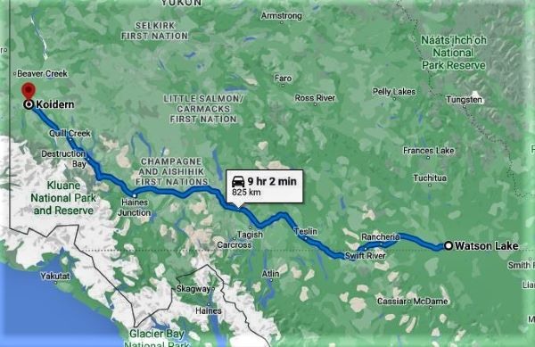
North of Destruction Bay the road was one continuous series of construction areas (the dusty good sections) and broken pavement with potholes (the bad sections). On the above map, Destruction Bay is the last section on the west side. Destruction Bay is almost at the end of our second day’s travel crossing the Yukon on the Alaska Highway.
Building the Alaska Highway
The Whitehorse trailblazing and construction crews built the Alaska Highway from Whitehorse to and beyond Watson Lake and to the north where they met the southbound construction crews working from Fairbanks Alaska. Building the road wasn’t easy but the section between Fairbanks and Watson Lake was easier to build than the road from Fairbanks to the Alaska Border. The most difficult part of building the northbound road started at Destruction Bay and led to the Alaska Border.
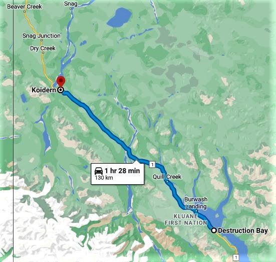
Road problems began in Destruction Bay. It was a good decision to split the known bad section of the road into two parts. We did the first seventy miles of bad road on the first travel day saving the rest of the bad road for after a very nice stay at Discovery Yukon Lodging. Over the span of two drive days, we had a total of 180 miles of bad road including two construction zones that totaled at about thirty miles long.

The scary part of the drive was in the dirt sections where large trucks were going in the opposite direction and kicking up rocks. This is one of the reasons that we try to avoid driving our RV on gravel roads. Since 2017 we have had to replace the windshield in our RV twice. In both cases, the cause was flying rocks from trucks. We also had to replace the windshield in the car once but now we have a cover that helps protect the car windshield. After driving on these roads we often find stones that hit our car along for the ride. These stones were probably kicked up by our RV, not by other vehicles.

The section starting at Destruction Bay to Tok Alaska presented a new challenge to the construction and a new challenge of maintaining the Alaska Highway. Most of this section of the road was built on top of soil that was frozen year-round.
Stunted Black Spruce trees grow in a thin layer of soil on top of the permafrost. If you remove this top layer then the permafrost below it melts and turns the road into a muddy ditch. When winter arrives the muddy ditch turns into a frozen dirt/ice road only to thaw again the next spring. The trick to road building and maintaining the road over permafrost is to keep it frozen, even during the summer months.

In 1942, the way to build a road across permafrost was to scrape as little of the topsoil off the road as necessary and then replace the topsoil with logs cut from the forest. Then gravel was put on top of the logs. This created a functional road that wouldn’t melt and become a mud bog. Today these sections of the Alaska Highway still create the largest maintenance problems. Every year thawing and freezing of the soil in the permafrost areas cause the roads to crumble. Getting a job repairing the Alaska Highway is not just a job, it is a career.
Discovery Yukon Lodging
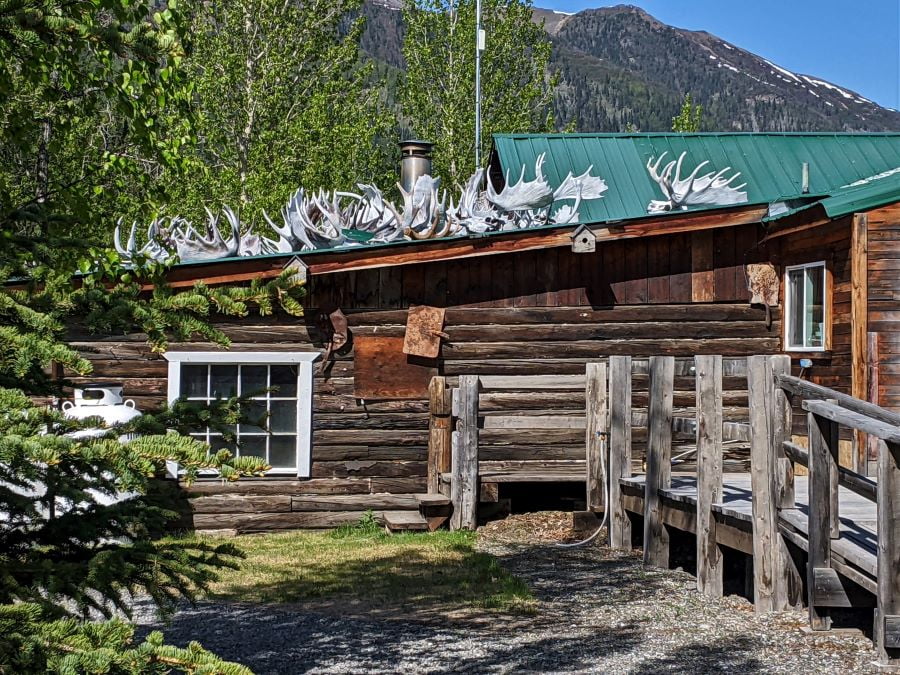
The very best stop on this trip through the Yukon, for us, is Discovery Yukon Lodging. Discovery Yukon Lodging is located on the Alaska Highway well to the northwest of Whitehorse, just shy of the Alaska Border. During the construction of the ALCAN, the Lodge was a major construction hub and includes a large grass airstrip.

I am happy that we will be going back to Discovery Yukon Lodging on our way south and will mention it again with more details about it and the construction of the Alaska Highway when I report on our southbound trip this fall.
Crossing the Yukon the Easy Way
I am convinced that crossing the Yukon through Destruction Bay (the way we did it) is the easy way to drive to Alaska. An obviously easier alternative is to fly. Even though the road between Destruction Bay to Tok Alaska is horrible it is shorter and better than the other road.

Two ways to drive to Alaska
There are only two ways to get to Alaska by road. You can take the Alaska Highway the entire route from Dawson Creek to Alaska. Or, you can take the Alaska Highway to Whitehorse and then follow the Yukon River to Dawson City then back south to Alaska. The second route, through Dawson City, is much longer.

The easy way to drive to Alaska
In the northwest, Tok is the first city in Alaska. Every other settlement is a tiny town (at best). The distance between Whitehorse to Dawson City then to Tok is a little over five hundred miles. The distance between Dawson Creek through Destruction Bay and then to Tok is less than 400 miles. If it was a good road versus a bad road then the extra one hundred miles might be a good trade. The problem is that the road through Dawson City is also a bad road. The easy and shortest way to drive to Alaska is on the Alaska Highway through Destruction Bay through Tok.
The hard way to drive to Alaska
Crossing the Yukon to Alaska via Dawson City is the hard way to get to Alaska. First, the route is more than one hundred miles longer than the route through Destruction Bay. Second, even though it is longer, the road is just as rough or maybe even rougher than the road through Destruction Bay. We didn’t make that drive ourselves, but saw some RV’s right after their arrival from Dawson City caked with mud as evidence of how bad the Dawson City route really was.
The road through Dawson City may be slightly better than the Destruction Bay route (we didn’t do it so we don’t know from first-hand experience). However, the road between Dawson City and Tok includes the Taylor Highway in Alaska and the Top of the World Highway in Canada. This section is just as bad or worse than the Alaska Highway through Destruction Bay. Besides the bad road, going to Alaska via Dawson City involves taking the ferry across the Yukon River.
Closed in the winter
Another piece of evidence is that the Alaska / Canada Border crossing outside of Dawson City isn’t open during the winter. This is largely because the Yukon River can be a moving river of ice until after melting in the spring. The ferry is shut down during the winter months. Thus the only year-round way to drive to Alaska (and stay on a road) is to take the Alaska Highway.

Please subscribe and join us on our journey
We will add you to our email list and send you updates about once a week. Here is a link. Subscribe
About our links
As you know, our blog income is zero – this allows us to be independent and just tell the truth. We do not get income or commissions. No, we don’t make paid endorsements. We don’t make recommendations but instead, we will tell you what we like (or dislike). The links are only provided as a quick reference to help our readers.
Links
The start of our Alaska Highway story. Going North on the Alaska Highway
The second leg of our Alaska Highway story. Stunning Northern Rockies on the Alaska Highway
Milepost Guidebook found on this website is updated annually and you can use the book even without internet data. First published in 1949 it is the bible for travel in Alaska and northwestern Canada.
Historic Mileposts on the Alaska Highway website with key mileposts
Alaska Highway 75th Anniversary
Miles Canyon on the Yukon River
About Comments
We love seeing your comments but they are not automatic. I get about twenty spam comments every day and thus I don’t have automatic comments. I read and then publish every comment personally to protect the blog and keep it on the subject and real. So what this means for you is that you will not see your comment right after you hit submit. Sorry for the delay in publishing your comments. Please know that we love hearing from you.


You are so right – we went up to Alaska last year via Dawson City, and came down the Top of the World.
We watched a brand new Dutch Star sit, teetering, off the side of the gravel road which had collapsed when the driver moved to the outside to let another trailer go by on the inside.
The road gave way, a few small trees kept them from plunging into a ravine, and they had to escape via the driver’s window. That rig sat there for 3 days until two cranes came from Anchorage to right it. We would never take that route again.
Boy, sorry to hear about the horrible road conditions! I know you did your research before this trip, so you were aware: dealing with a short stretch of horrible road is the sacrifice RVers have to make in order to get to Alaska by road.
In 2010, when we did our first camping trip with friends, to Alaska. We pulled a travel trailer with no slide…it was lightweight. Our friends had a Class-A and lost only one wind$$$heild. We didn’t have any damage, but we went about 25 mph. , and the TT config is more flexible than an A-class.
We went to Dawson City! That was amazing because the whole town is a national historic park!
We were supposed to be on the Top of the World Highway into Chicken, AK, but the heavy rain that year washed out the bridge. It was supposed to be repaired quickly, but after 3 days, we all decided to head back to Whitehorse and get to AK through Tok. So we doubled back and doubled our horrible permafrost road experience.
Scott, this article brings back “fond” memories! But it’s so gorgeous in that area, it’s hard to NOT take fabulous pictures!
Reading these reports is bringing back so many memories from our trip last year. To be sure, there are some horrible spots on the Alcan. We chose to avoid the Dawson City route because of reports of the route after Dawson City not being suitable for large vehicles. Who knows if we were right. We did get a series of good laughs from the signs warning of severe dust, end of construction, new construction, severe dust, end of …. That remains one of the laughs of the trip. We saw a bumper sticker on the side (yes, the side) of a motorhome that said, “ALASKA HIGHWAY UNDER CONSTRUCTION: ALL 1422 MILES OF IT.” I do get nostalgic about our trip and we both wonder how soon we can do it again.
Pingback: Where is the end of the Alaska Highway? - FoxRVTravel
Scott, you and Tami certainly have cajones. I enjoy reading your accounts, even if I can’t get to them for a while sometimes. Stay safe you two. Happy Fourth of July from the lower 48. Chip
Pingback: How to Plan (and Take) an Epic RV Trip Across Canada to Alaska - FoxRVTravel
Pingback: Our 2023 epic travel adventure - FoxRVTravel