The road is closed and the wildfires are between us and Alaska. We need a route around the wildfires. Our schedule is shot. Campgrounds are closed. The good news is that because we started our reroute around the wildfires near Edmonton, we have options. If this were to happen further north on the Alaska Highway, our only option would be to retreat.
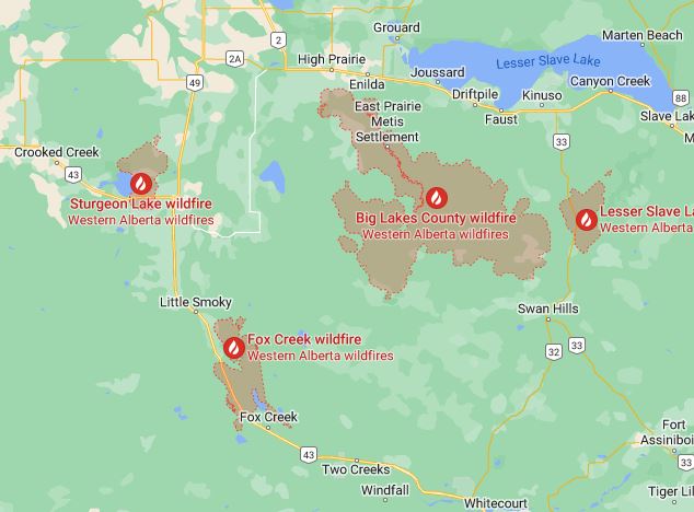
Our intended route from Edmonton was to follow Highway 43 northwest through Fox Creek to Valley View and Grand Prairie (located above the top left of the above map). The Fox Creek fire closed Highway 43. The Sturgeon Lake fire has caused evacuations in Valley View. We were going to stay at a Harvest Host farm located on the west side of Sturgeon Lake, but it was seriously affected by smoke. We cancelled our reservation at the farm. Smoke is everywhere.
Fires in Alberta and British Columbia
Most of the fires are in Alberta and British Columbia. At the end of May, two more major fires are to the east in Saskatchewan. This year nearly one hundred wildfires are in Alberta and last week twenty-five of them were burning out of control. At the end of May, more than two million acres have burned in Alberta.
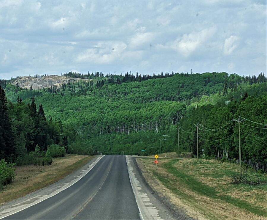
Smoke Everywhere
Smoke from these spring wildfires is affecting air quality to the south all the way to Denver and east all the way to France. Generally, the prevailing wind is from the northwest and has spread the smoke across a huge area.
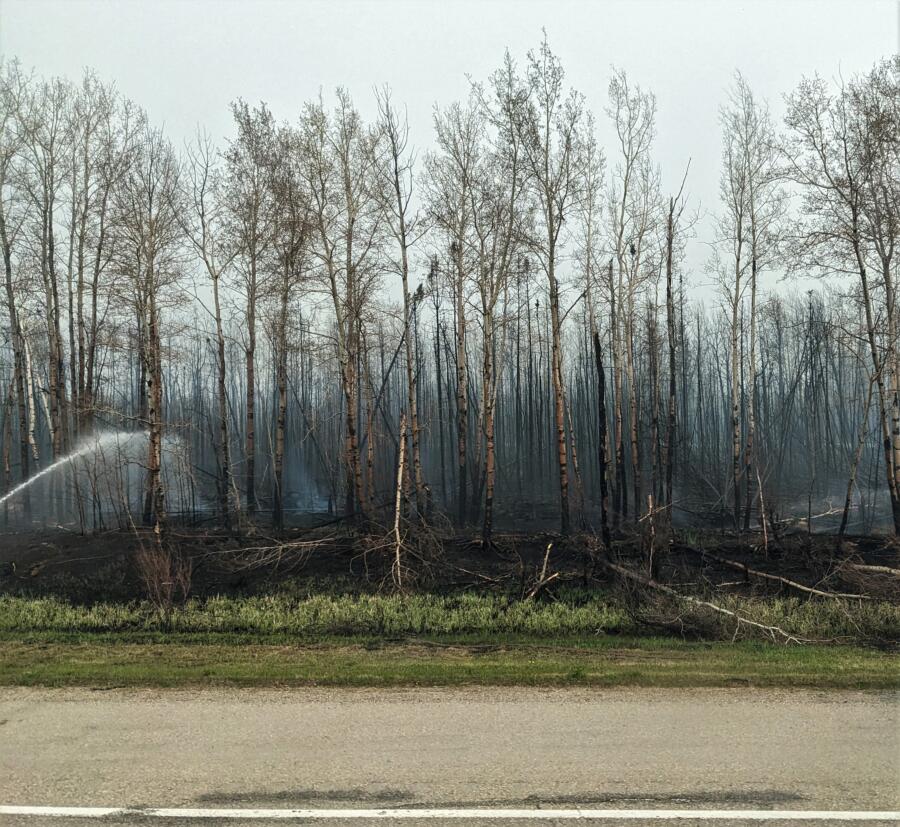
Really, since Alberta closed the roads going through the affected areas, our biggest problem is smoke downwind of the fire. If we are going to go around the wildfires we needed to stay away from the highest concentration of smoke. Since the winds were due to change caused by a passing cold front, we couldn’t rely on the wind being consistently from the northwest. The cold front was moving much slower at this time of year than typical, thus it would have less unstable air creating thunderstorms. A slow-moving cold front is good news.
The slow-moving cold front was good news because fast-moving cold fronts are frequently preceded by thunderstorms. With thunderstorms, you can get more fires started by lightning. This happened in British Columbia less than a week ago.
Options for routes around the wildfires
The first undesirable option was to retreat to the south. Escaping the smoke from these fires was impossible, so this isn’t a good option. If we could get further north into the Yukon and Alaska we would be north of the fire and north of most of the smoke.

The second option we seriously considered was to wait at our campsite northwest of Edmonton. This could have been a good plan if the cold front brought us the desired rain. Until then we would have been in heavy smoke. Sometimes waiting is better than going around the wildfires.
A push-your-luck option (and was our original plan before the fires) was to head west to Mayerthorp. Mayerthorp is well east of the Fox Creek fire but close enough that if then Highway 43 were to open through Fox Creek we could quickly dart through the newly opened road rather than go around the wildfires. This move would save us lots of miles but would the road open soon?

The smoke from the northwest was choking Edmonton. The airflow was from north to south. South of Lesser Slave Lake, the Lesser Slave Lake fire has closed Highway 33. From Edmonton, Highway 2 can take you north around the wildfires to Lesser Slave Lake and north of the fire zone. At Lesser Slave Lake, you could then travel westbound and stay north of Valley View and the Sturgeon Lake Fire. After that, you then could go further west to Grand Prairie. This plan was a good one to go around the wildfires.
The option that we choose gave us relief from the smoke as we went around the wildfires that same day. We headed west out of Edmonton towards Jasper National Park on Highway 16. Once we got to the entrance to Jasper we could stay the night. This option took us through a smoky area caused by the controlled burn (photo above), but was a good route around the wildfires.

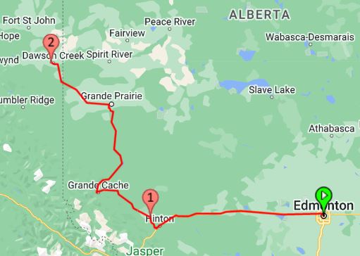
Once we got to the entrance to Jasper National Park, we could turn north to Grand Prairie. Or we could keep going west across Jasper National Park and then north through British Columbia to Alaska. The good thing about the Grand Prairie route was that we would still see the Alaska Highway. The bad thing about the Grand Prairie route was that northwest of Grand Prairie there is yet another fire zone. This new fire zone is north of Dawson Creek on the Alaska Highway. As for this option, this new fire zone, there wasn’t any good way to go around the wildfires north of Dawson Creek.
One thing about going west, was that we were going to add about 60 extra miles to our journey. Since Highway 43 was closed, we were going to have to add extra miles regardless of our travel direction. This was an easy decision. Going west promised blue skies (at least for the day) and relief from the smoke. The really good thing about heading west is that we had options that we would not have had we headed north towards Lesser Slave Lake.

When at the entrance to Jasper National Park, we could route even further to the west through Jasper National Park further around the wildfires. The good thing about heading further west through Jasper National Park and then north through British Columbia was that we would be completely west of the fires but British Columbia had other issues with flooding and we would lose our trip up the Alaska Highway.
Our route around the fires
The slow-moving cold front had the possibility of widespread rain in Dawson Creek so we chose to go north from Hinton staying out of Jasper National Park. We spent one night near Hinton at William A. Switzer Provincial Park at the Gregg Lake campground. The next day drove north through Grand Prairie to Dawson Creek.
The route we chose to the west of Edmonton wasn’t free and clear. Right along the road, east of Edson (between Edmonton and Hinton) we had some serious smoke and found a controlled burn. Well to the northeast of Edson, there was yet another fire evacuation at Niton.
William A. Switzer Provincial Park
From the Gregg Lake campground, we could make the decision the next morning to proceed further west through Jasper National Park and British Columbia or north through Grand Prairie and Dawson Creek.
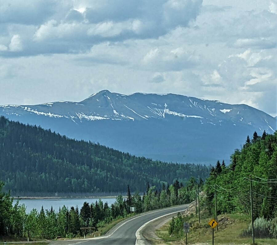
We didn’t make that decision to go north to Grand Prairie until the morning after we saw that widespread rain from the cold front was expected. Dawson Creek (at the start of the Alaska Highway) was expected to get the most rain of anywhere in the region. Our plan was to park right in the middle of it. Besides putting out fires, rain can remove the smoke from the air. We arrived at Dawson Creek, while it was still early in the day it was a good decision and a reasonable goal.

Our stay at Gregg Lake
We really didn’t do nearly enough research to discover how suitable William A. Switzer Provincial Park and the Gregg Lake campground would be for our RV. Then upon arrival, we took the biggest longest campsite available. A phone call earlier that morning assured us that there were sites available that would fit our RV. Given that it was a Canadian holiday, a three-day weekend, we needed to get there as soon as possible.
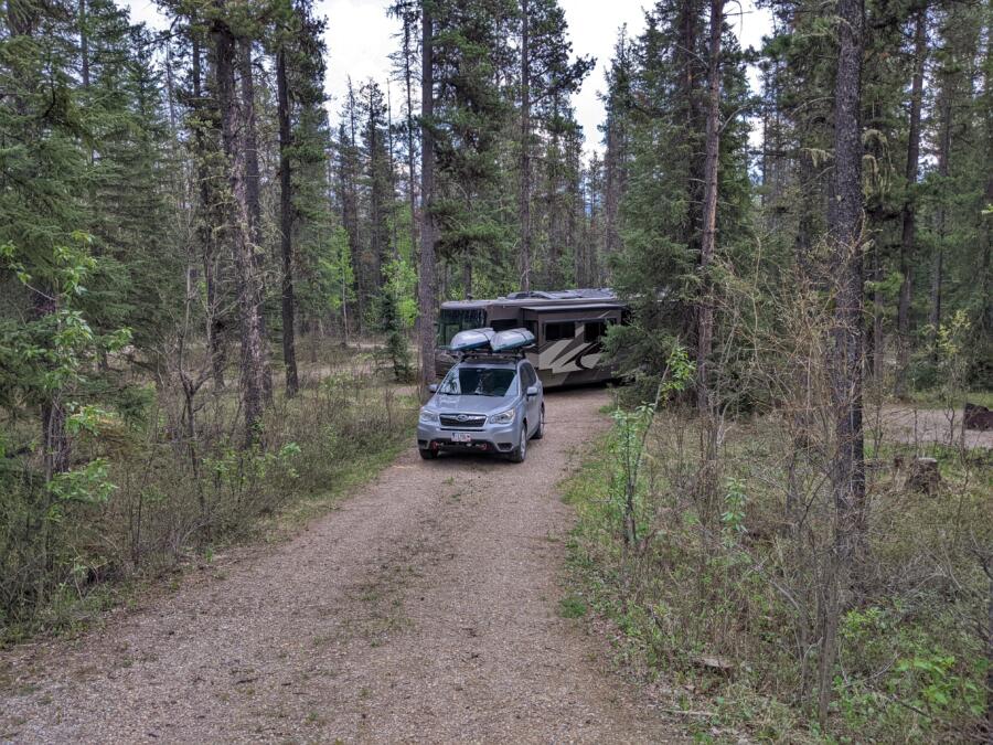
Gregg Lake campground had several other shorter campsites which would have been much more comfortable than our super long campsite. Our site looks good in our pictures but overall it was nearly impossible to level the RV. The campsite was terraced with three levels. The place we chose to park was in the picnic area. The site was a pull-through, but we had to pull in, then back out when we left.
I had to drag the picnic table out of the way so we could camp where it was placed. While parking I trimmed a few bushes. Then before departure, I trimmed a few more. If you go to Gregg Lake in a large RV, don’t pick sites in loop “A” numbers 9-11. Site A-6 would have been great but it was reserved and sat empty for the night.

When making the corner into the campsite we never really accomplished aligning ourselves with the normal parking area and didn’t want to anyway because the slope problem would have been exaggerated. Again, it is hard to tell that Tami was well above me when taking this picture.
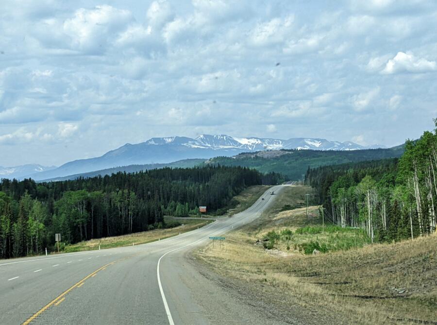
Our campsite was a comfortable site once we got parked and we had clear skies. We were even able to sit outside and enjoy the evening. Everything inside the RV, inside our car, and outside at the campground, smelled like smoke.
Dawson Creek or Jasper?
I already told you that Dawson Creek was the result of our decision-making at Gregg Lake and our original plan. Just as expected, we got all the rain we expected over the next two days at Dawson Creek. The rain was putting out the fires on the Alaska Highway to the north of Dawson Creek. It was a good thing, because there wasn’t any way for us to go around the wildfires north of Dawson Creek, other than through Jasper National Park. We were going right through the middle of the Red Creek fire zone on the Alaska Highway.

I mentioned before that our campgrounds along the way canceled our reservations. We had cancellations at one campsite at Fox Creek, and two campsites north of Dawson Creek. North of Dawson Creek we lost a campsite at Charlie Lake which was just to the south of the Red Creek fire zone. Then we lost the campsite Buckinghorse River.
Buckinghorse River was well to the north of the Red Creek fire zone but close to the Donnie Creek fire. The Donnie Creek fire was burning until the rain storm, and although we couldn’t see any of it from the road this fire too covered a large area. When we drove north on the Alaska Highway we couldn’t see any smoke to the east. Perhaps it was extinguished by the rain storm.
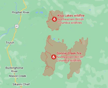
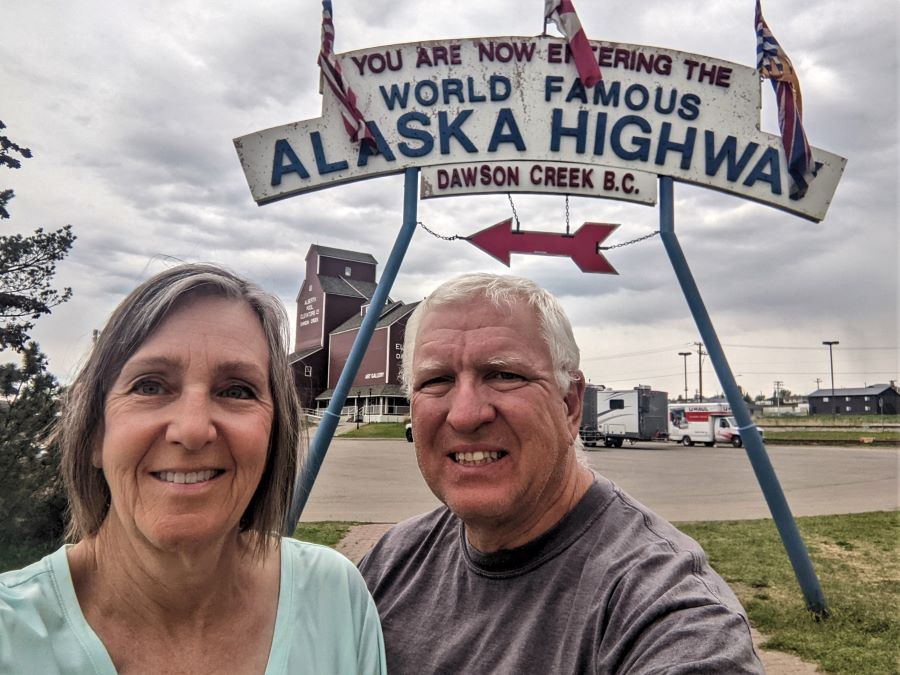
Last Sunday I mentioned that we arrived at mile marker zero which was the start of the Alaska Highway. I guess that this week was all about how we got here, perhaps next week I will start describing our trip up the Alaska Highway past the fire zones and all the way to Muncho Lake. Don’t miss next week’s pictures of Muncho Lake. As I write this I am mostly looking out the window watching the water drift by.
Please subscribe and join us on our journey
We will add you to our email list and send you updates about once a week. Here is a link. Subscribe
About our links
As you know, our blog income is zero – this allows us to be independent and just tell the truth. We do not get income or commissions. No, we don’t make paid endorsements. We don’t make recommendations but instead, we will tell you what we like (or dislike). The links are only provided as a quick reference to help our readers.
Links
Windy Windy is a weather app that includes forecasts for things such as wind, clouds, and rain. It also reports and predicts air quality. It is like having a personal global weather forecasting service. Some of the pictures on this post came from this website.
British Columbia Road Conditions Map
British Columbia Emergency Map
British Columbia Emergency Alerts
Google Maps Google Maps also has an overlay of fire problems. After opening Google Maps, hover your cursor over the Satellite image then select “more” to see the available layers. Under Map details select the Wildfires overlay.
William A. Switzer Provincial Park
Buckinghorse River Wayside Park
About Comments
We love seeing your comments but they are not automatic. I get about twenty spam comments every day and thus I don’t have automatic comments. I read and then publish every comment personally to protect the blog and keep it on the subject and real. So what this means for you is that you will not see your comment right after you hit submit. Sorry for the delay in publishing your comments. Please know that we love hearing from you.


Ugh. Having traveled in and around the awful wildfires of 2020, this post stressed me out. The canceled plans, the rerouting, the uncertainty. None of that is fun. I’m glad you were able to get to Dawson Creek safe and sound and hope the rest of your trip will be smoke-free.
Ugh, so sorry you are dealing with all of the smoke (obviously, I am sorry for Canadians as well!). Do you guys run any kind of HEPA air filter inside the rig? I have often thought about having one just in case . . .
Am having adventure envy. Love reading your posts and recommendations. We hope to make it to Alaska in our Phaeton summer 2025. Good luck and keep posting!
Safe travels, try to get some shots of the Northern Lights! Love it when I get one of your thorough updates. Both of you enjoy the journey.
Stay safe on the Alcan you guys, thinking of you.
We have reservations to rent an rv and drive from Seattle to Anchorage June 16, 2023. Should we cancel? Any routes recommended or ones to avoid. Thanks
Currently, the conditions are great. Stay west while in British Columbia. The Alaska Highway from Destruction Bay to Tok is always bad so it doesn’t matter which year you travel this. The road through Dawson City is always worse and that means the Alaska Highway is always your best choice.
We are in Prince George at the moment and do not know if it is a good idea to drive north… and we have another problem: our car is a van from Europe and needs ULS (ultra low sulfur) diesel. Do you know the availability of ULSD along the Alaska Hwy? Thanks for your nice page!
Sorry Jeanny, I don’t know. Dawson Creek has several locations that might have ULSD. It really is the only town of size. Can you make it 300 miles? then Fort Nelson is the next place. After that, I would be astonished to find any ULSD fuel. Make sure to call ahead.
Pingback: The Cassiar Highway is the wildest part of Canada - FoxRVTravel
Pingback: How to Plan (and Take) an Epic RV Trip Across Canada to Alaska - FoxRVTravel