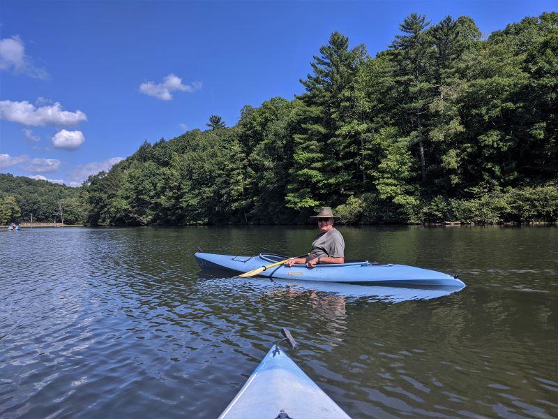
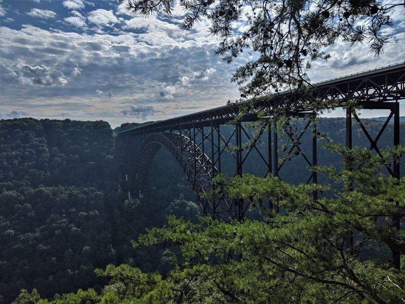
It wasn’t the plan, but we have been following the New River for most of the summer. I love the irony that the “New River” might be the oldest river in North America and one of the oldest rivers in the world. The New River is about 330 million years old. The New River starts in North Carolina in the Smoky Mountains near where we stayed on the Blue Ridge Parkway and flows north from North Carolina northbound across Virginia. In West Virginia, the New River changes names and becomes the Kanawha River.
Older than the mountains
The New River is older than the Appalachian Mountain Range that it crosses. The mountains were pushed up and then eroded around the New Rivers path. The river was there first. Unlike most rivers in the area, the New River flows to the north. Most of the rivers in the Appalachian Mountain Range flow eastward toward the ocean or westward towards the Mississippi. The New River divides the Appalachian Mountains and gathers its water from both the east and the west, sending it north.

Naming Rivers
Naming Rivers is a combination of the first name, whatever sticks, or largest flow. In Grand Junction Colorado, the Colorado River joins the Gunnison River. The name Colorado River describes the river for the rest of its path to the Pacific Ocean. Had the people naming the river concluded that the Gunnison River was carrying more water, the name all the way to the ocean could have been Gunnison rather than Colorado. The Ohio River joins the Mississippi River and since the Mississippi carried more water. The name Mississippi name was retained. The Ohio River is obviously a tributary of the Mississippi.
Mistakes and Exceptions
Since all these were named based on conclusions that may not have been true, or may have been true at the time, there have been mistakes and hard and fast rules don’t really apply. The Yellowstone River carries more water than the Missouri River but the name Missouri name pre-dated finding the Yellowstone River and thus the Missouri River name persists.

Lewis and Clark
Lewis and Clark’s first goal was to find the headwaters of the Missouri River; they chose not to first explore the Yellowstone because they thought that it carried less water than Missouri. After finding the source of Missouri they descended on the west side of the Rocky Mountains and continued all the way to the Pacific Ocean. Then they walked back.
Kanawha and New River
North of the New River Gorge National Park (the park is less than a year old) the Gauley River joins the New River becoming the Kanawha River. The Kanawha River was already found (and named) further to the north. This was before the New River was found from the south. The Kanawha name could have been the name all the way to the source in North Carolina. Maps at that time were less precise and they probably concluded that the New River was a different river than the Kanawha.

Starting in Blowing Rock North Carolina, the New River flows through Virginia, across the Great Appalachian Valley and then in West Virginia becomes the Kanawha River. In West Virginia, the Bluestone and then the Gauley Rivers join the New River. As the Gauley River joins the New River the Kanawha name takes over. Here the river becomes far tamer and will support barge traffic. The hope was that the New River would be a shortcut across the Appalachian Mountains (from Virginia to Ohio). This didn’t work because of the rapids caused by the steep drop and deep canyons. The New River Gorge is the deepest canyon in the northeast.

New River and the Industrial Revolution
Timber, coal, and iron production fueled the Industrial Revolution. Rivers first and then trains made all of this possible. Train tracks were built into and across the Appalachian Mountains for the express purpose of extracting the riches in the area. One of these train tracks was (and still is) at the bottom of the New River Gorge.

Thurmond and Hinton
We visited the bottom of the New River Gorge and explored the towns of Thurmond and Hinton. Both of these towns were created because the train came through the canyon. Both were dedicated to extracting the riches of the area. Thurmond is now a ghost town except for the train stop. Hinton is a pretty big town, with the exception that many of the buildings are empty. It is nearly a ghost town. Population in Hinton has been decreasing since 1930.

Before Trains
Before the train tracks were laid, the rivers were the transportation in the area. Mostly they moved timber downstream. The Gauley River shows the scars of this use and will never recover. After the logs were thrown into the river they would get caught on the major rock outcroppings. The rocks that were causing the logjams were blasted into smaller (smaller than houses) jagged boulders with dynamite. The same thing happened on the New River and Bluestone until the train tracks were built into the canyons.

With the trains came the ability to move the coal. Coal mines dot the region. There is still an abundance of coal in the mountains but we are moving away from using coal as a fuel. With each coal mine, they established a coal camp (company-owned town). Today the tangle of trees and bushes, and the steep terrain it would be hard to find the old abandoned coal camps. Towns along the river disappeared as anything valuable was loaded on the train and the remainder was left to rot in the rain.
Recovery
Starting about the time of the Great Depression almost all of the timber was already stripped from all the mountains. Only a few old-growth trees remained. Gradually the mountains started to get new trees. Really it was a race between the erosion of nearly all the topsoil and the new growth. In the 1950s first, the state and then the federal government started carving up the New River drainage in West Virginia into chunks to preserve the waterways as public parklands. The easy-to-find and extract coal was depleted and the trees were coming back – but they were too small for sawmills.

Mud and Silt
Dams on each of the three major rivers were built to control flooding. The dams changed the river while protecting downstream towns from annual flooding. The lack of flooding changed the river bottoms that started as hard rock bottoms and started filling with mud and silt. The water warmed due to the lack of flow and this changed the fishing from trout to warm water fish. Because of erosion, pollution, and coal dust, the nickname for the Gauley was the Ink River.

Starting on Labor Day, the Gauley River’s dam has scheduled massive water releases that duplicate the bottom cleaning floods and the Gauley becomes a whitewater rafting and kayaking paradise. Although the annual natural flooding was in the springtime, the water releases are in the fall to prepare for the winter rains. They have started (20 years or more now) doing the same thing below Lake Powell on the Colorado River. Sadly with the Colorado River, controlled flood events may not be able to continue due to drought and overharvesting the water.
Making Parks
What we are enjoying now is a conversion of the New River watershed from wasteland to amazing parks. These parks are all linked together along the river and protect, section by section, the river from the previous extraction of resources. The list of parks in West Virginia along the waterway is (from south to north) Pipestem and Bluestone State Parks, New River Gorge National Park, Babcock and Hawks Nest State Parks, and Gauley River National Recreation Area. Most of the New River drainage is now a park in West Virginia.

More Dams
The New River area was threatened by more dams but the attitude towards dams and industrial development changed and gradually the local governments joined the movement away from industry towards recreation. Each of the major rivers already had dams and these dams provided adequate protection from floods. The New River and Bluestone River have regained status as wild rivers, downstream from their dams and the Gauley River has become a Mecca for whitewater enthusiasts.
Playgrounds
In West Virginia, the parks along the rivers are designed for playing. Rock climbing and rafting are popular year-round. At Pipestem State Park, golf and zip-lining are the choice activities. Sightseeing, mountain biking, and hiking are popular in every park. The state of West Virginia made these parks what they are to be enjoyed as playgrounds. I usually don’t see this level of effort after creating a state park to create a playground (for adults).

Our New River trip included our stop at Claytor Lake State Park which is on the New River. Here is a story about the plantations in the area. Two Virginias An interesting thing is while along the New River, we found that the locals were very hard to understand and we describe this in the post. Wampus caterwauling
North Carolina to Ohio
There is enough fun and beauty along the New River starting in North Carolina all the way to Ohio that a person could easily spend the entire summer exploring the area. We didn’t set out to follow the New River but rather lucked into the route. Had we known that our route would have followed the oldest river in the country we would have been more deliberate following it.
Please subscribe and join us on our journey
We will add you to our email list and send you updates about once a week. Here is a link. Subscribe


Great blog post! It makes me want to visit the area.
Very beautiful & informative. Especially the river naming. The has a beautiful landscape.
Thanks for Sharing,
Enjoy your continued adventure & blogs
You never cease to amaze me with your choice of words and in-depth research.
Take care friend and keep um coming!