More than ten thousand years ago the Matanuska Glacier ended in the ocean where it combined with the Knik Glacier and formed the Knik Arm of the Cook Inlet north of Anchorage. As the glacier receded, it left the Matanuska Valley and Matanuska River as a testament to its size and power. Where the glacier once stood, Matanuska Valley ends north of Anchorage in Palmer.
Chugach Mountain Range
To the east of Anchorage and spanning most of the southern Alaska mainland, is the Chugach Mountain Range. To the east of the Chugach Mountain Range is the Saint Elias Mountain Range. To the north of the Chugach Mountain Range are the Talkeetna Mountains and the even bigger Alaska Mountain Ranges. To the northeast is the Wrangle Saint Elias Mountain Ranges. Between the Chugach Mountains and the Talkeetna Mountains is the Matanuska Valley.

The Chugach Mountains, at 13,000 feet, are a continuation of the mountains that span the coast of Canada and Alaska. Compared to the Chugach and Alaska Mountain ranges, the mountains further north, the Talkeetna Mountains, are like foothills between the two ranges at 5,900 feet. On our visit to Denali National Park, in the Alaska Mountain Range, I discussed Denali, a massive mountain more than 20,000 feet high. If you missed the story here is a quick link. Denali

Nominally, the area covered by the Chugach Mountain Range is about 100 miles (starting to the east of Anchorage to Thompson Pass, north of Valdez) and 40 miles from Prince William Sound to the Matanuska Valley.
Whittier is at the west end of Prince William Sound. The mountains to the north of Whittier, are the Chugach Mountains. Whitter gets more rain annually than Sitka, Seattle, and Portland COMBINED. I described how wet Whittier was in this post. Beautiful Whittier

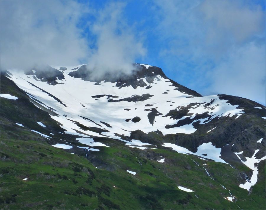
To the north of Whittier, all this rain turns into snow and has covered the Chugach Mountains with a vast icefield. Most of the Chugach Mountain Range is covered with ice. From the Chugach Mountains ice cap, I count more than ten major glaciers going both north and south. The largest glacier going to the south is the Columbia Glacier. The largest glacier flowing from this massive ice complex to the west is the Knik Glacier. To the north, three major glaciers flow from the Chugach Mountains. The largest of these is the Matanauska Glacier.

The Glenn Highway
The Glenn Highway starts in Palmer and climbs up the Matanuska Valley to the northeast. The Matanuska Valley ends at Eureka Summit. Further to the west is Glennallen. The Glenn Highway ends in Glennallen 138 miles to the east. Every mountain to the south of this road is in the Chugach Mountain Range.
The Matanuska Valley and River
The Matanuska Valley is seventy-five miles long, not including the twenty-seven miles still buried below the Matanuska Glacier. Along the valley floor, the Matanuska River flows downstream until it enters the Cook Inlet south of Palmer. The Matanuska River looks like grey flowing concrete. The grey color is because the rocks that the water carries from the glacier down the valley have been ground into fine dust.

In 1908, the Matanuska Valley was part of the Iditarod Trail, which connected the gold fields in Nome to the port city of Valdez. The Matanuska Valley portion of the Iditarod Trail followed preexisting trails of the Tanaina and Ingalik Indians in the Interior of Alaska. It wasn’t until the Russians introduced dog sleds that the trail was traveled in the winter. I discussed the Iditarod trail in my last post. Here is a quick link. Exploring Seward

Even though the Matanuska Glacier supplies most of the water flowing in the Matanuska River, the headwaters of the river are further northeast near Eureka Summit at 3400 feet.

The Matanuska Glacier
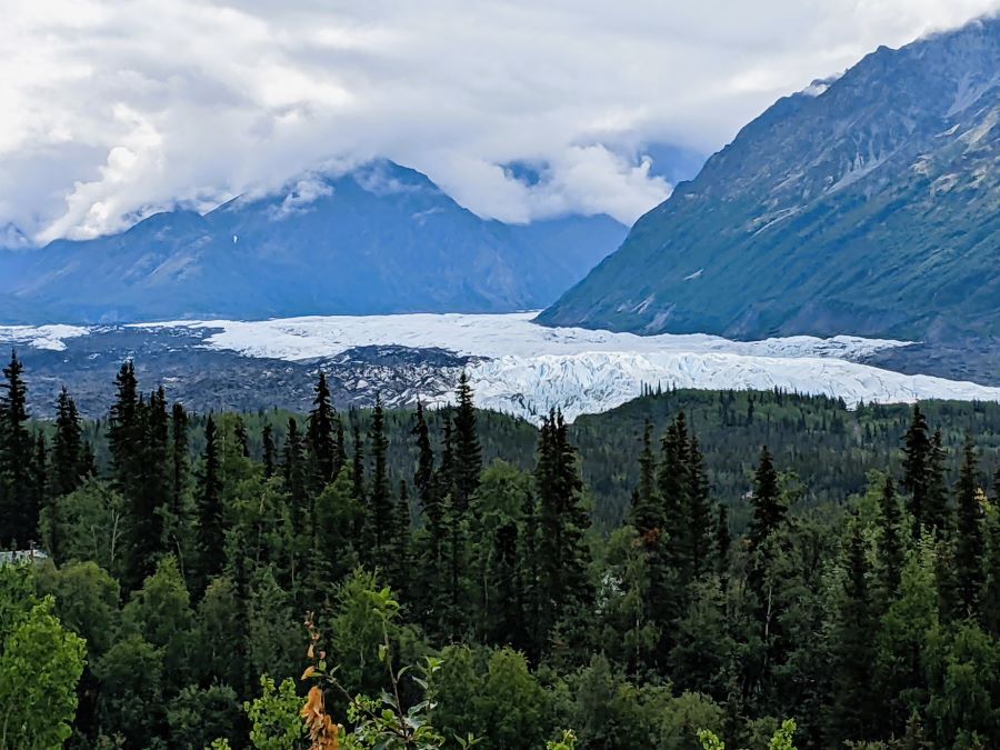
For the last one hundred years the icewall of Matanuska Glacier has been at about the same location. Many glaciers are receding, but the Matanuska Glacier at about the same location. The Matanuska Glacier is not advancing or receding. If you only read the sign at the viewpoint you would not know this fact. The impression at the sign is that all glaciers are getting dramatically smaller each year. Of course, the Matanuska Glacier is receding, if measured over the last ten thousand years! It has receded more than one hundred miles including the entire Knik Arm of the Cook Inlet.

The Matanuska Glacier is moving downhill at a rate of about one foot per day. The movement of a glacier is much like cold maple syrup. As more and more snow is added to the icefield at the top of the Chugach Mountains the ice is compressed and flows downhill carving the mountain valleys. It takes a massive amount of snow added to the top of an ice cap to make a glacier flow downhill. If the added snow is ample, then over time, a glacier advances.
The area covered by the Chugach Mountains has more snowfall than any area in Alaska. There is plenty of snow falling and accumulating each year to keep the glaciers flowing. Even though snowfall at the top of the glacier feeds the downhill movement, it is not the primary determinant of glaciers’ receding or advancing. Warmth at the ice wall, at the terminus of a glacier, is making most glaciers recede.

Glacier View
Glacier View is near the top of the Matanusk Glacier icewall. We had a very nice day for a drive and started this trip after our stay in Eagle River. Overall the drive was 88 miles. We had already spent a week in the Palmer area almost a month before, so the quick trip to Palmer for us was nothing new for us. About half the way to our campground at Glacier View we passed through the town of Sutton-Alpine. Curiously, the lowest price for fuel was here, in a small town, well to the east of Palmer so we topped off our fuel tank. Fuel prices will be going up from here on as we return to the lower 48 in Washington.

Grand View Cafe and RV Park
The Grand View Cafe and RV Park was our home for the next two nights. This gave us time to explore the area and go back to the viewpoints that we passed as we drove up the Matanuska Valley. We discovered that the town of Chickaloon was really just a location and not a town. Further east we passed Long Lake which is one of hundreds of lakes that were created as the glacier receded over the last ten thousand years.

How to view the Matanuska Glacier
Unless you want to pay an access fee and actually walk on (or with a guide, climb on) the glacier, the best viewpoints to see the Matanuska Glacier are right on the Glenn Highway. Most are free except for the State Park where a parking fee is required, unless you happen to be camping in the campground. Except for the days close to the fourth of July, the campground was quiet. There were only six spots at the campground and instead, we camped at the Grand View Cafe and RV Park.

Glacier View Car Launch
The biggest surprise on our visit to Glacier View was the Glacier View Car Launch. Had we known about it, we would have joined the thousands of Alaskans who annually visit the car launch on the fourth of July. On the fourth of July, we were staying in Palmer and could have easily made the 40-mile drive as a day trip. Perhaps next time we visit Alaska we will have a better plan.
Running cars are launched off a 300-foot cliff and fly into the valley below. When I say running, I mean that the engines are running and carrying the cars to the end of the cliff. The steering wheels are strapped to keep the wheels pointed in the correct direction. The cars are started and somehow the engines are revved to a high RPM accelerating towards their final flight. Some cars follow a single train track built to keep the cars going towards the cliff. Other cars are left to decide their own route toward the edge.
What could be better than seeing a car fly off a cliff? Perhaps the answer is two cars flying off the cliff at the same time. Or perhaps a motorhome. The landing will show you how well motorhomes are made. Here is a YouTube video of the show. Watching it is a hoot.
Fireworks on the fourth of July in Alaska are not a big deal; mostly because it never gets dark during the summer. If it never gets dark, then there isn’t a reason to go to a fireworks show. Perhaps they do that in the winter, at about 4 in the afternoon. In Alaska, they also have unannounced shows of the Aurora Borealis. We didn’t see the Aurora Borealis on this trip. We missed it. In order to see the aurora, first you have to be there when it gets dark. Summer is the wrong time of year and it can’t be cloudy. We had plenty of clouds when we were in Alaska.
Please subscribe and join us on our journey
We will add you to our email list and send you updates about once a week. Here is a link. Subscribe
About our links
As you know, our blog income is zero – this allows us to be independent and just tell the truth. We do not get income or commissions. No, we don’t make paid endorsements. We don’t make recommendations but instead, we will tell you what we like (or dislike). The links are only provided as a quick reference to help our readers.
Links
Matanuska Glacier State Recreation Site
About Comments
We love seeing your comments but they are not automatic. I get about twenty spam comments every day and thus I don’t have automatic comments. I read and then publish every comment personally to protect the blog and keep it on the subject and real. So what this means for you is that you will not see your comment right after you hit submit. Sorry for the delay in publishing your comments. Please know that we love hearing from you.


It is fun following your trip this summer. You include so many facts that bring things alive. Thanks for sharing.
Hard to believe that place is even real. Just amazing views. The car launch is the most ‘murica thing I’ve ever seen. LOL.
Laura, I want you to know that I am old enough to not pretend to know something that I don’t know. I used to just nod and pretend as if I understood. Not anymore, I just admit it and look it up on my brick of knowledge (cell phone).
Murica was one of “them” words that this “hick” doesn’t use in normal conversation. I agree, it was a hoot.
Pingback: Valdez is the most important city in Alaska - FoxRVTravel
Pingback: Deep into the ice flows at the Columbia Glacier - FoxRVTravel
Pingback: Southbound on the Alaska Highway - FoxRVTravel